Based on hands on technical expertise in the field of manipulation with different forms of spatial data, Netserv can offer its customers several methods of data acquisition and processing. We use mainly our own sources, knowledge and equipment, while for mass acquisition we provide adequate link between the contractor, contracting authority and the final user of our services.
With every acquisition and before the processing of spatial data we make sure that they are adequately spatially placed (different methods of acquisition use different procedures of georeferencing). However, acquisition and processing are not enough; therefore, our work processes include different quality controls. Precision of spatial data is important information for the user and is indispensable in the evaluation of the quality of the results of data processing. For this reason our services are subjected to adequate standards, which assures adequate knowledge about positioning and thematic accuracy and completeness of spatial data, as required for successful implementation of any spatial analysis.
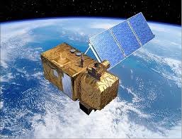
We purchase satellite images directly from distributors, or else downloaded from the European space Hub, by specifying our precise demands regarding the level of processing, location and quality of data.